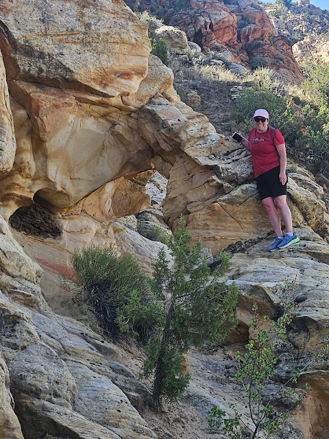
Painted Arch
 |
| Painted Arch, near Hurricane, Utah |
We went on a hike to Babylon Arch, which is near Hurricane, Utah - about 30 minutes from Saint George. As I was looking at Google Maps of the area, I noticed Painted Arch on the map nearby. I decided I wanted to find it, and that's where the adventure began! Google Maps claimed it was only 2 minutes away from my current location, which was right by the trailhead for Babylon Arch. But when I tried to follow the navigation on Google Maps, it took me off on a wild goose chase -- no where near where the arch actually is. I did some investigating online and we decided to go back to our car and navigate using just the pin of the arch on Google Maps and the directions we found online. We did find it, but it took some exploring. This is how you can find it:
Follow the google maps directions for the Babylon Arch trailhead, and instead of turning right at the very end, continue straight. Drive until you get to the cattle guard, and pull over and park. If you're in an ATV, or a four-wheel drive car that you feel very confident can drive through deep sand, then you can continue driving on the sandy road all the way to where you leave the road for the arch (just under one mile). But it is VERY sandy all the way to where you leave the trail. It is under a mile from the cattle guard to the arch (.93 miles), so it is not a terrible hike, and the part on the trail is obviously easy to follow. Follow the sandy dirt road until the road forks, and take the right fork. There is a fence that lines the road on the right for most of the hike. Continue to follow the road until the fence veers away from the road to the right, then take about 65 steps further up the road before leaving the trial towards the right. If you get to the top of a hill that is slickrock instead of sand, you've gone too far. I put a cairn on the side of the road where you should leave the trail, but it's not likely to still be there when you go. You can't see the arch from where you leave the road, so if you've gone about .85 miles since the cattle guard, you know to leave the trail on the right. The arch is in the rock formations next to the trail, only about fifty feet off the dirt road. It is not a big arch - it's probably under 7 feet high. I'm not sure why it's called Painted Arch, but it might be because of the colorful slickrock around the arch.
Here are photos to help you find your way to the arch:
Take I-15 until the Leeds/Silver Reef exit (exit #22) and follow Main Street through Leeds until you reach 900 North, then follow 900 North for almost 4 miles and pass the Sand Cove Trailhead. This is where you will continue going straight rather than turning right to go to the Babylon Arch trailhead. If you haven't already hiked to Babylon Arch, it is a definite MUST! And unlike Painted Arch, it is very well marked.
 |
| signs along the dirt road while driving in |
 |
| We actually saw 2 tortoises on the trail! |
We were driving an expedition, and we weren't sure it could make it through the deep sand without getting stuck, so we parked it just before the cattleguard. I'm really glad we did. I'm pretty confident that we would have gotten stuck in the sand.
 |
| Right after walking over this cattle guard, take the dirt road to the right (the road separates) |
.JPG) |
| The beginning of the road down into the sandy dirt road just after the right turn |
.JPG) |
| This type of sand is what the entire road is like |
.JPG) |
| The fence follows the road almost the whole time. When the fence veers away from the road off towards the right, that is when you are almost to the point where you should leave the road - about 65 feet past the fence veering off |
.JPG) |
| That trail that you can see veering off to the right past the fence line is not the correct trail. I'm not sure where it goes, although it appears that many people use it. That trail does not go to Painted Arch. Keep following the road. |
.JPG) |
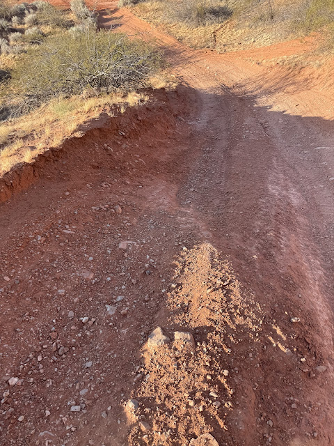
| If you reach these slickrock paths, you have gone too far and should turn around. When the sand ends and slick rock begins, you have gone too far. |
We were watching the Painted Arch dot on Google Maps as we were walking. We followed the dirt road and kept getting closer to the dot, but when we realized that we were getting farther away from the dot, we knew we had gone too far. So we went back and looked more carefully to the right of the trail.
.PNG) |
| If you are looking at Google Maps with satellite view and zoom in really close, you can see the trail that takes you right to the arch. It is just a matter of knowing when to leave the trail, since you can't see the arch from the road. Just don't try using google maps navigation to find it - it won't take you to the arch. |
.PNG) |
| We ended up finding the arch by walking until we were directly on top of the arch on the map, and then we saw it. The google maps mark wasn't exactly at the arch - whoever posted it must have been looking at the arch rather than standing under it. My blue dot in this photo is standing under the arch. I did update the location in Google Maps, so maybe it will take you right under the arch now. |
.JPG) |
| This was our first view of the arch, although we had turned around on the trail after going too far, so if you're coming up towards it you'll have a different view of these rocks that house the arch. |
.JPG) |
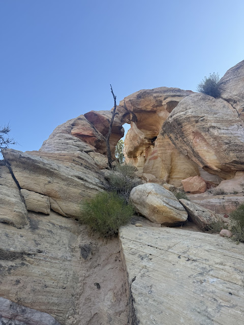
| If you look carefully you can begin to see the opening |
.JPG) |
| I went down around the side to try to find a way up into the arch, and I saw this tiny window on the side of the arch. My husband took an easier way up to the arch, which you'll be able to easily find if you come off the trail at the right point and are approaching the arch from the other side |
.JPG) |
| This is looking up at the arch from the side that you can climb into it |
.JPG) |
| My husband climbing up to the arch. It is very easy to climb inside it from this side. |
.JPG) |
| This view is from the front of the arch. It gives you an idea of how big the arch is - I am 5'2" |
.JPG) |
| The small window on the side that I walked past on my way to climb into the arch, taken from inside the arch |
.JPG) |
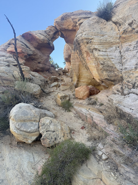
| view of the arch from the ground before climbing up |
.JPG) |
| the back side of the arch |
.JPG) |
| The back side of the arch |
.JPG) |
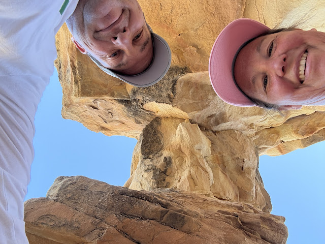
| My husband and I underneath the arch |
.JPG) |
| under the arch |
.JPG) |
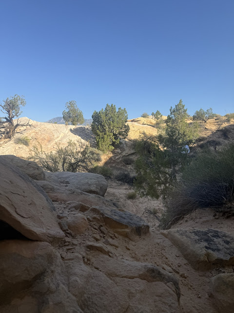
| view out the back while standing under the arch |
.JPG) |
| view out the front while standing under the arch - you can't really tell from the photo that there's a drop-off a few feet past the front of the arch |
.JPG) |
| my husband and I took photos of each other through the little window in the bottom of the arch |
.JPG) |
| the front side of the arch |
.JPG) |
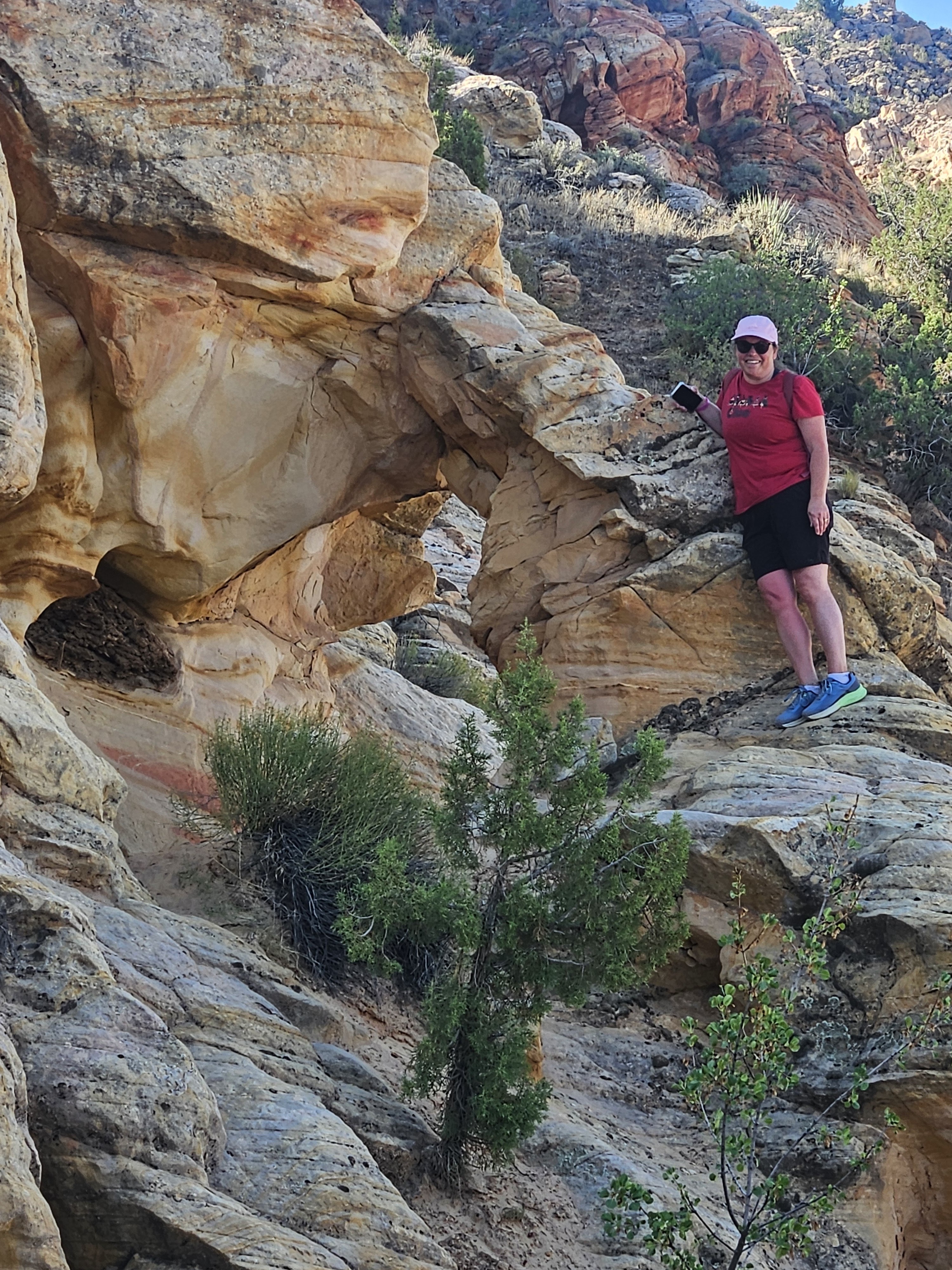
| Me standing beside the arch on the front side |
 |
| beside the arch on the front side |
 |
| This is as far on top of the arch as I dared to get. Someone more daring than I could climb directly on top of it if they wanted to. I've seen photos of people on top of the arch. |
.JPG) |
| The back side of the arch |
.JPG) |
| The view when approaching the backside of the arch |
.JPG) |
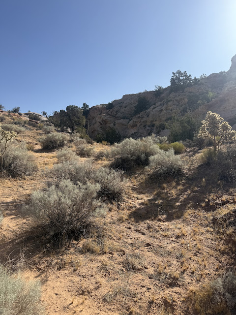
| The view of the mountain when you leave the trail towards the arch |
.JPG) |
| I added this cairn where you are supposed to leave the road to walk to the arch. Hopefully it stays there for awhile. |
.JPG) |
| This is the view up the road from where you should leave the road to head towards the arch. If you get to the top of this hill where the slickrock starts, you have gone too far. |
.JPG) |
| Hopefully there will be footprints to follow when you see the cairn and leave the road |
.JPG) |
| This is the view back down the trail from where you leave it for the arch |
.JPG) |
| This is where the fence veers off to the right and you count about 65 feet before going off the road to the right. This view is looking back at the fence after passing it. |
.JPG) |
| This is where the fence veers away from the road, from the perspective you'll see when walking up the trail towards the arch. Count about 65 feet and then leave the road towards the right. |
.JPG) |
| A farther back view of the fence veering away from the road |
.JPG) |
| view of the fence that's to the right of the road on the way up, taken on our way back down |
.JPG) |
| view of the road heading back down |
.JPG) |
| view out to the right on our way down the trail |
.JPG) |
| back through the sand again. This junction you keep left on the way back. |
.JPG) |
| This junction be sure to turn right on the way up. I put a cairn there, but with all the ATV traffic I doubt it will be there long. When heading towards the arch, turn right here! |
.JPG) |
| My tiny cairn |
.JPG) |
| Walk straight through this opening in the fence on the road |
.JPG) |
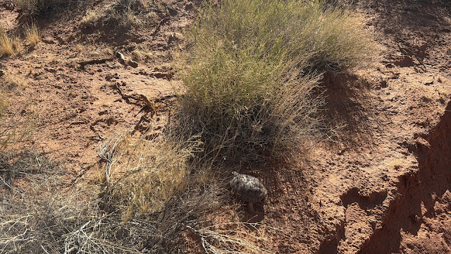
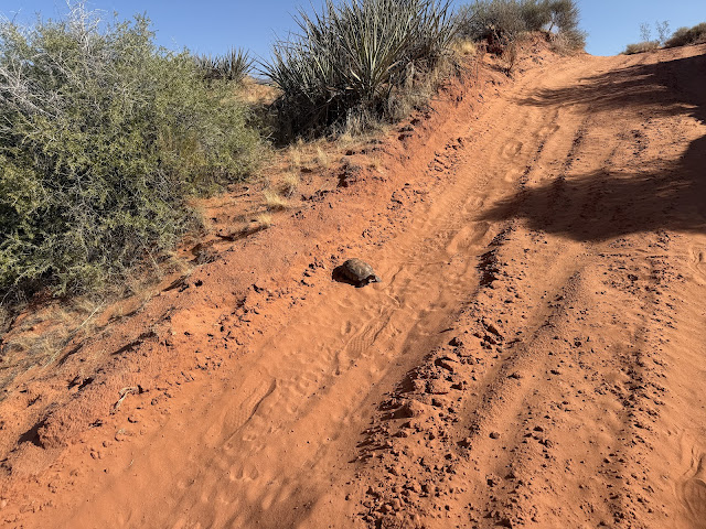
I almost didn't notice this little desert tortoise in the middle of the trail!
|
.JPG) |
| It is hard to tell from the photos how small this tortoise was -- he was about 5 inches long |
.JPG) |
| After he knew that we weren't going to hurt him, he began walking to the side of the trail. He didn't sink into the sand, he left tiny footprints. I watched him try to climb up onto the side of the trail, which was too high for him until he found a lower ledge. |
.JPEG) |
| The tortoise made it up the side of his "cliff" |
.JPEG) |
| Then he got stuck in a bush and had to figure out a way around it. We left him at this point and continued on the road. |
.JPG) |
| Pretty soon after we came upon a bigger desert tortoise -- this time about a foot long. |
.JPEG) |
| She didn't move at all while we were watching her. |
.JPEG) |
Several dirt bikes went past soon after we saw her, so I really hope she got off the road in time!
|
.JPG) |
| the last hill before the cattle guard |
.JPG) |
| view from where we parked |
.JPG) |
| After hiking both to Babylon Arch and Painted Arch my shoes were so completely full of sand - it felt like there was a whole cup of sand in them! When I dumped them out, the sand just kept on coming! And after I got home and took the insoles out, even more sand fell out of them! |
 |
| This is the one-way route from Painted Arch back to the cattle guard where we parked. The green dot is the arch and the red dot is the cattle guard. |
 |
| This is the route we took finding the arch, with the blue dot being at the arch. We only went a little too far before realizing we needed to turn back around. The green dot is where we parked our car at the cattle guard. |
Painted Arch is not a big arch, but it is an easily accessible one when you know where you're going! And it is easy to climb inside of. Other arches in the area include:
* Babylon Arch
* An unnamed arch near the Babylon Arch trailhead that is high in the cliffs
* A jug-handle arch, also near the Babylon Arch trailhead
* An arch that I saw off in the distance that I got a photo of
* several tiny arches on the hike to Babylon Arch, as well as tiny ones inside Painted Arch
On my Natural Atlas map it lists a "natural arch" close to Babylon Arch, and I'm not sure if it's referring to Painted Arch or one of these other ones, or if there's another arch entirely that I didn't find yet! Based on my screenshots of both the Natural Atlas and Google Maps, it appears that the "natural arch" is Painted Arch.
.png) |
| Notice the line between Babylon Arch (the brown arch highlighted on the map) and Sandstone Mountain, with the "Natural Arch" passing through that line. Then compare it to where Painted Arch lines up on the Google Maps below. |
 |
| Babylon Arch |
 |
| Arch off in the distance viewed from Babylon Arch trailhead |
.JPG) |
| I named this arch Babylon Window because I can't find the name of it, although it is located very close to the Babylon Arch trailhead. I couldn't figure out a way to get up to it. |
 |
| I named this arch Babylon Jug-handle, because it is also right next to the Babylon Arch trailhead and I can't find the name of it. |
Other Arches in the St. George Area
Here are some resources to enhance your hiking experience in and around St. George Utah.
Disclaimer: As an Amazon Associate, I earn on qualifying purchases. This is at no additional cost to you.


.JPG)
.JPG)
.JPG)
.JPG)
.JPG)
.JPG)
.JPG)
.JPG)
.PNG)
.PNG)
.JPG)
.JPG)
.JPG)
.JPG)
.JPG)
.JPG)
.JPG)
.JPG)
.JPG)
.JPG)
.JPG)
.JPG)
.JPG)
.JPG)
.JPG)
.JPG)
.JPG)
.JPG)

.JPG)
.JPG)
.JPG)
.JPG)
.JPG)
.JPG)
.JPG)
.JPG)
.JPG)
.JPG)
.JPG)
.JPG)
.JPG)
.JPG)
.JPG)
.JPG)
.JPG)
.JPG)
.JPG)
.JPG)
.JPG)
.JPEG)
.JPG)
.JPEG)
.JPEG)
.JPEG)
.JPG)
.JPEG)
.JPG)
.JPEG)
.JPEG)
.JPG)
.JPG)
.JPG)


.png)
.png)

.JPG)

.JPG)


.JPG)
No comments:
Post a Comment