 |
| Blackwater Natural Bridge |
Deep in the Wyoming wilderness is one of Wyoming's greatest natural wonders - an arch that is rumored to be one of the largest in the world, sitting atop a steep cliff made of volcanic rock. Estimates list its height as anywhere from 100 to 280 feet tall. Consider that the famous Delicate Arch in Arches National Park is 52 feet tall and imagine stacking 5 1/2 Delicate Arches inside this arch opening! I first heard about the arch when Bill Sniffin included it in one of his books of beautiful photos of Wyoming. Socializing at a Rotary luncheon, my husband James asked Bill how he'd gotten to the arch. Sadly, he had never been there - he'd been given the photographs by other adventurers who had made the trek to see the arch.
Over the next few years, I asked everyone I met from Cody if they'd been to the arch. None of them had even heard of it. I couldn't understand why such a beautiful and majestic arch could have remained a secret even from its neighbors! I looked up all of the information I could find online about the arch, which is very little. Wikipedia lists the arch as being at an elevation of 10,777 feet and lists estimates of measurement, although the arch has never officially been measured because of its remote and inaccessible location. I saw a Facebook video of someone standing on top of the arch with his drone flying around and through the arch. I commented on the video, asking how he'd gotten on top of the arch, but he didn't respond to my comment. I read an article about Devin Butler, who had hiked to the arch with his drone, determined to measure its size, but was impeded by thick timber on the ground below the arch, as well as its high distance off the ground, and never was able to make the measurements or the 3D image that he was hoping to make. In the comments below the article, he said that he actually did obtain images, but had problems with the firmware for the drone. He intended to make a documentary about his visit to the arch, but I have been unable to find that documentary anywhere, so I doubt it has been completed yet. Another comment under the article said that a man named Ras Bales, now deceased, had visited the arch when he was 24 years old and stood inside it for a picture. Having been there now, I cannot fathom how he could have gotten inside it. He called it the "Keyhole in the China Wall." I wonder if the back-side of the arch, which is on wilderness land instead of Shoshone National Forest, is somehow accessible to be climbed into, although I suspect that my fear of heights would definitely keep me down on the ground.
I made a goal this summer to finally see this mysterious arch in person, but our summer filled up with other plans and it appeared that my goal would have to wait until next summer. But then I saw a possibility for the arch to fit into our busy summer. My husband is a commissioner for the 9th Judicial District on the Wyoming State Bar of attorneys, and his August meeting just happened to be in Cody. I suggested that we get up early the morning after his meeting and at least attempt to hike to the arch. We had thought that we might have to hire someone to take us in on horses, but we love to hike, and we figured that we had nothing to lose (assuming we didn't run into any bears! - this is in grizzly territory, after all) by making the attempt. If we had to, we could just turn around and try another time.
The date of our hike was August 12th 2023. Earlier in the week we went to our forest service in Lander,
Wyoming to purchase a map of the area and try to get more information. The lady at our forest service office had never heard of the arch. She put us in touch with a lady
at the Wapiti forest service office, who gave us what turned out to be the most valuable information for our hike. She emailed 3 copied pages from an old hiking book that someone had left in their office. It listed the hike as a 14 mile round trip (we had heard that it was a
10 mile round trip, so we were glad to have talked to her so that we would be more prepared). The pages also listed lots of details about
the hike that turned out to be extremely helpful! Without these pages, I am not sure that we would have been able to find the arch. Even still, they were not completely accurate, because when we finished the hike, our GPS tracker said that our round-trip hike had been exactly 17.02 miles. We took selfies at each mile. The arch came into view at exactly 8.54 miles as we summitted Sheep Mesa, the mesa adjacent to the cliff wall where the arch resides. We had considered just trying to follow Blackwater Creek to stand directly below the arch, but I don't think we would have been able to see the arch from below because of how high it is on the cliff and the slope of the cliff (although I think this is the direction that Devin Butler came from when he attempted to officially measure the arch).
My husband James, son Teancum, and I left Cody just after 6 a.m. to drive to the trailhead. We started the hike at 6:53 a.m. from the parking lot for the
Firefighter Monument trail. Don't park in the parking area for the Firefighter Memorial that is just off of Highway 14/16/20. Coming in from Cody, the turn to the trailhead parking is not marked, but coming from the other direction it is, so if you make it to the Memorial, turn around and drive back less than a mile to the turn for the trailhead to the Blackwater Firefighter Monument. This is the site where 15 firefighters were killed in a wildfire caused by a lightning strike in 1937. We were the only car in the trailhead parking lot, both when we arrived and when we left. In fact, other than the workers at the horse camp next to the parking area, we did not see any other people the entire hike. There is a turn-off in the parking lot to drive to a footbridge, which I believe would have cut one mile each way off our hike, but the road to the footbridge was closed and gated off on our visit. Perhaps this is why the author of the hiking book listed the hike as a 14 mile round trip - he may have cut a mile off his trip each way by driving to the further parking lot (although it still would have been 15 miles according to our GPS tracking. Plus, he listed the creek crossing at the beginning of his description, so I guess we just don't know why he listed the hike at 14 miles round trip). I am not sure if this footbridge cutoff is closed permanently or if it just happened to be closed for our visit.
 |
| sign at the beginning of the trail |
 |
| sign in the parking lot |
 |
| James just heading out on the trail |
Immediately upon starting the hike we had to cross the creek. If you don’t
want to hike the entire trail in wet shoes and socks, bring water shoes to change
into on the many creek crossings. I
brought keens and just switched into them before each creek crossing and then
put my hiking shoes and socks back on.
 |
| my son Teancum walked barefoot across the creek |
 |
It was running pretty fast and the rocks were slippery
|
 |
| after crossing the creek it's pretty muddy on the other side |
There were lots and lots of horse hoof prints on this portion of the trail. Many people must go on trail rides to the Firefighter Monument, because those horse prints all but disappeared after the routes divided.
 |
| Teancum clipped my wet keens onto the back of his pack and carried them for me. I used them three more times during the hike, and could have used them more, but was able to cross some of the creek crossings by just rock-hopping. |
 |
| headed out on the trail |
 |
| One mile |
This was our view at one mile
Don’t hike
in shorts! The trail towards the Firefighter
Monument is very well maintained, but once the road forks and you head towards
the Blackwater Natural Bridge, the trail is obvious but has vegetation
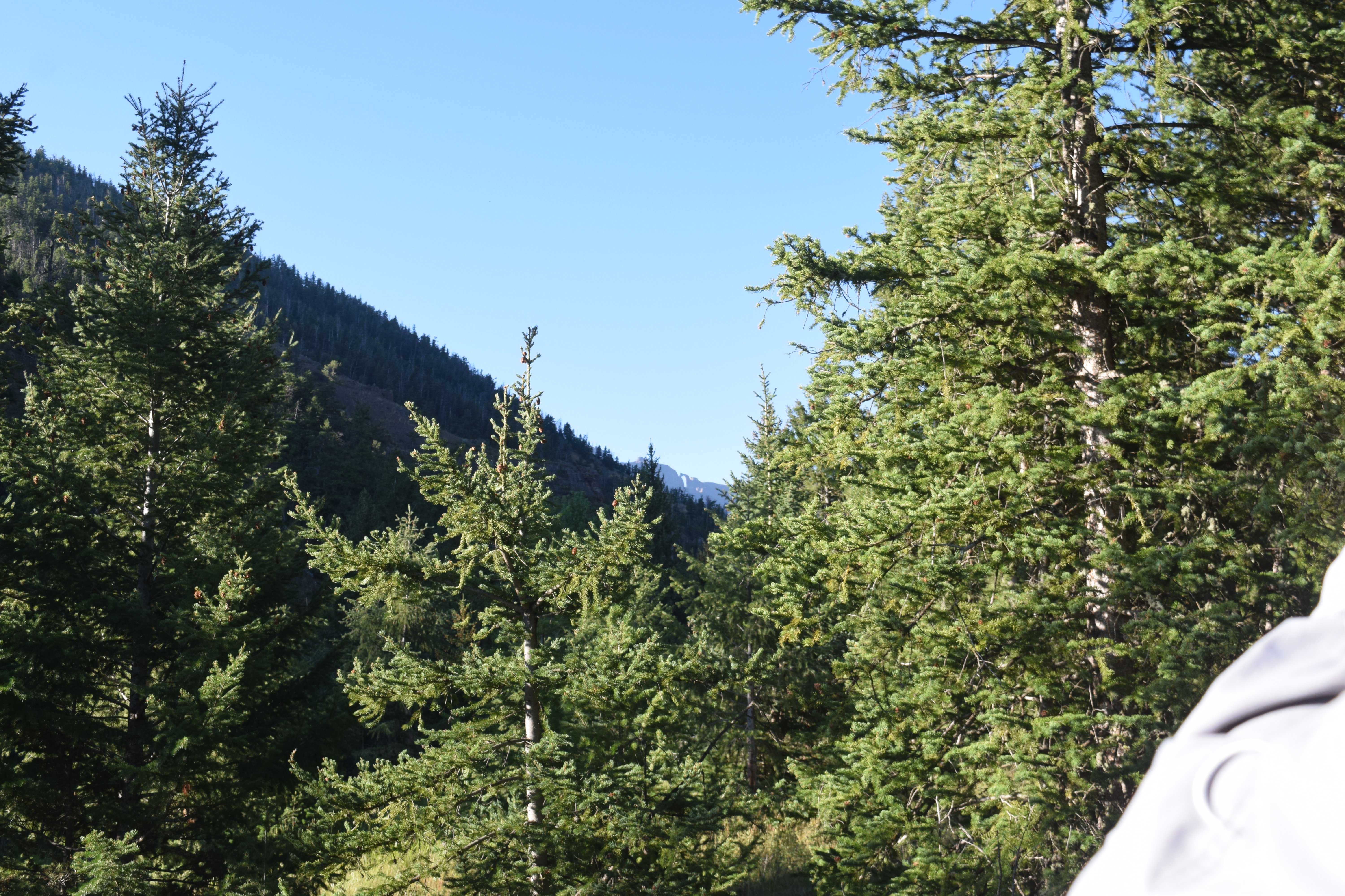
waist-high and encroaching on the trail. I usually like to hike in shorts, but I was very, very glad that I had hiking pants on instead. I would have ended up with very scratched-up and itchy legs by the time I was done if I'd been in shorts. The weather for us was absolutely perfect! It was warm enough that we didn't need jackets for the majority of the hike (although we were glad we had them with us for Sheep Mesa). We were under the cover of trees for most of the hike. We encountered heavy winds and a few drops of rain at the end of our trail on Sheep Mesa, but the rest of the time the weather was absolutely perfect for hiking!
A little over a mile into the hike there is a fork to the left with
another creek crossing. Don’t go this
way – there’s not a sign, but it is not the right direction. Keep to the right and continue on the trail until you see a sign
pointing you towards either the Firefighter Monument or Blackwater Natural
Bridge.
 |
| creek crossing off to the left on the trail - don't take this turn |
 |
| another little path by that same creek crossing - keep following the trail to the right, don't take either of these side trails. |
 |
Mile 2 of the hike
|
 |
| Panoramic view at mile 2 |
Just after mile 2, at exactly 2.15 miles into the hike, we had our first sighting of Blackwater Natural Bridge way off in the distance! This made me very excited -- our goal was in sight! We wouldn't see the bridge again until 8.54 miles into the hike. From what I've read, you can also view the arch off in the distance from the Firefighter Monument. This makes me even more curious as to why local residents who have probably visited the monument didn't also trek to the arch! Surely it must have looked very tempting off in the distance...
 |
| our first sighting of the arch - in the middle of the photo, right on the ridge of the cliff |
 |
| our mileage tracker at the moment we saw the arch |
.JPG) |
| These two were taken with my camera rather than my phone, so a little higher resolution |
As we continued to hike over the next few minutes we continued to see the arch through the trees, but pretty soon it disappeared from our sight as we got further into the mountains. At 2.6 miles into the hike the trail to the Firefighter Monument (trail 758) forks and divides into the trail to the Blackwater Natural Arch (trail 775). We were following our map and
found an earlier fork off to the right, so we took that fork at first, but then
looked down and saw the sign back down on the original trail. It was lucky we did – I have no idea where that
other trail would have taken us, and this fork is not marked.
 |
| Forest Service map of the two trails. Begin on trail 758 and then switch to trail 775. The trail numbers are not marked anywhere that I saw on the trail. |
 |
| Teancum studying the map and trying to decide whether this was the fork that took us to the arch. |
 |
| We took this fork until we looked down below and saw the sign with the real divide in the trail. |
 |
| From the upper trail, notice the arch visible in the distance |
 |
| This is looking back the other direction on this higher trail. Teancum was taking a photo of the arch. |
Beautiful view of the arch from that upper trail. Maybe that's what that other trail is for - to get a better view of the arch. It doesn't ever join the real trail, though, so I wouldn't risk it...
 |
| Wait until you find this sign dividing the trail before you take a new trail (the arch trail actually continues straight, it's the monument trail that veers to the left) |
 |
| Notice how narrow the trail becomes at this point |
The information I had read said that this hike was strenuous.
I think that is an understatement. It is
by far the most difficult hike I have ever done! I would list it as extremely strenuous. The majority of it is uphill, especially the
last mile, which is straight up a steep mesa.
The trail is not well maintained after it divides from the monument trail, so there are lots of loose rocks. From the parking lot up to the 8 1/2 mile mark on Sheep
Mesa where you view the arch, the elevation change is 5072. According to my son's watch, we started at an elevation of 6255 feet and
finished on the Mesa at an elevation of 11,327 feet.
After the trail divided, the trail became more narrow and the vegetation on both sides of the trail was up to my waist many times. I was very glad I had long pants on instead of shorts. It is obvious where the trail goes, so we didn't have trouble following it. But at times it was hard to walk through it because it was so narrow. For the next several miles, the majority of the hike was uphill. We had a couple short down-hills, and several times where it flattened out a bit, but most of the time we were walking uphill. It is a work-out for your calves for sure! The trail did not stay narrow the whole time - it was mainly just this way for the mile or so after it divided.
 |
| panoramic view at mile 3 |
 |
| We saw lots of fresh berries on the hike - probably part of the reason that bears like the area so much |
 |
| mile 4 |
 |
| more berries on the trail |
 |
| Amazing tall trees on the entire trail! |
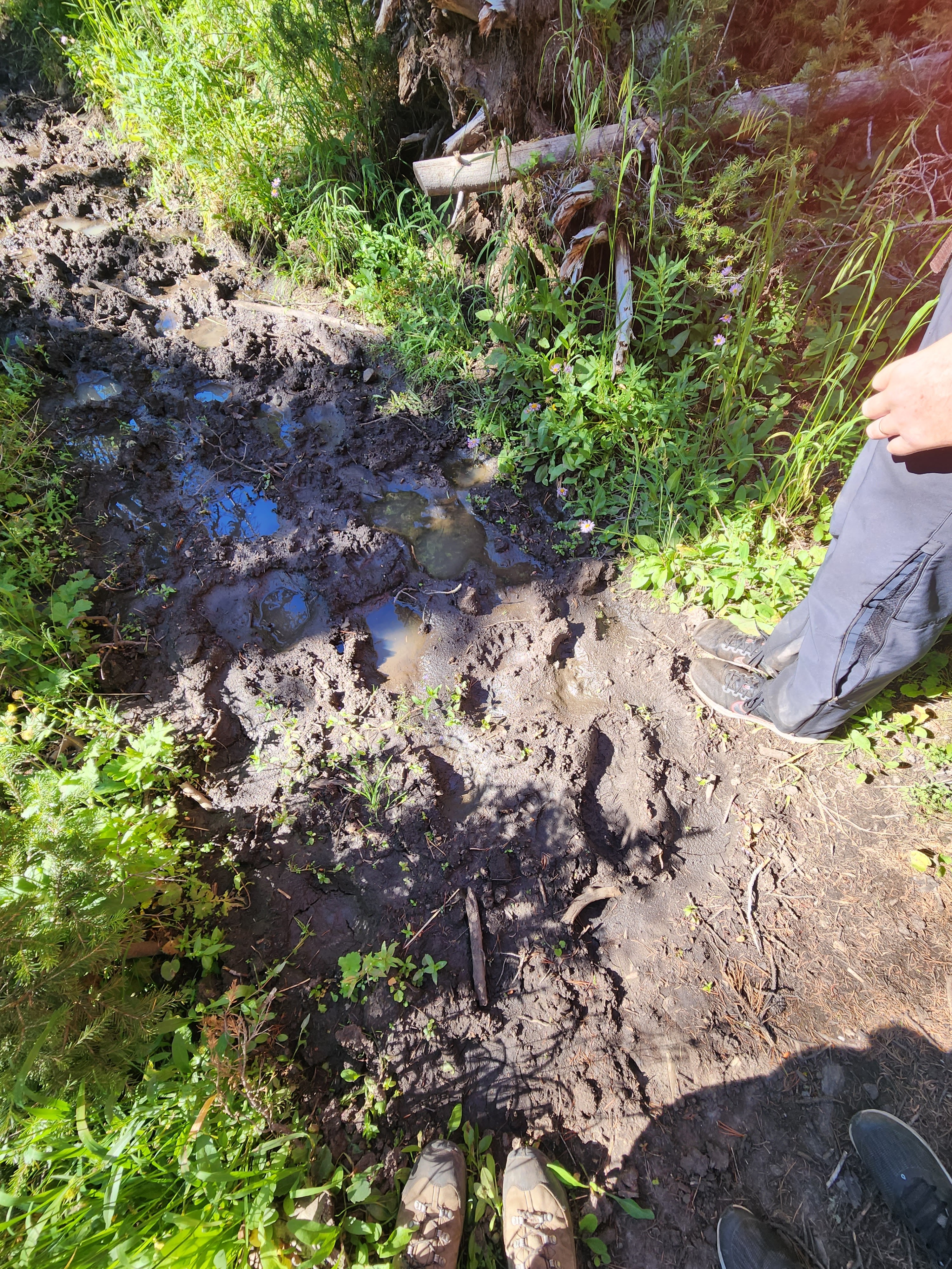
After mile 5 we saw our first bear sign - a paw print that appeared to be an old print, or at least not from that day. We also encountered a lot of mud.
 |
| mile 5 |
 |
| panoramic of mile 5 |
 |
| our first bear sign - luckily they appeared to be old prints |
 |
| we walked through quite a bit of mud. Sometimes we were able to stick to the sides and not get too muddy. Notice the bear print mixed in with others. We also saw elk prints. |
 |
| This meadow was a beautiful break in the trees as we were nearing our six mile mark. |
At 6.36 miles we encountered another creek. Teancum put logs across it to try to make a bridge, but I ended up still just switching to my keens to cross it. Up until this point I thought it had already been steep enough! I had to stop and catch my breath several times, and we were all making sure to drink lots of water. We were steadily increasing in elevation. After we crossed the creek just after mile 6, it became even more steep! This part was difficult coming back down because I was afraid that I would slip on the loose rocks and gravel. As hard as it was to climb up for the next mile, it was even more hard coming back down this section. The views were absolutely spectacular, though, especially when we came out of the trees into beautiful meadows or when we crossed through a drainage and could look up into the cliffs to our left and down into the beautiful valleys on our right.
 |
| mile 6 |
 |
| Teancum below some very tall trees |
 |
| panoramic view at mile 6 |
 |
this creek is at the 6.36 mile mark.

|
 |
| this tree blocked off a side trail that we could have taken. Thankfully once we passed the signed fork in the road, we weren't ever again confused about where our trail was. |
 |
| Teancum's attempt at a bridge across the creek. It looked like others had made similar attempts. |
 |
| we made it across. James always just walked across in his shoes and socks and then hiked with wet shoes. |
 |
| At this point the wild flowers became even more beautiful. You can kind of get an idea of how steep the climb was at this point, but I would say these photos still don't do it justice! I was on the trail - the vegetation was just very high and encroaching on the trail at this point. One interesting thing about our hike was that we didn't have any problems whatsoever with bugs. We didn't need to use the mosquito spray that we had brought. We hardly even saw any bugs other than an occasional grasshopper! And no mosquitos at all! |
 |
| This photo gives you a better idea of how steep the climb was during this section |
 |
| We spotted what we're guessing was a marmot a few yards down from where the trail crossed a drainage. |
 |
| The trail runs perpendicular to this drainage and such an amazing view! |
 |
| The view of the valley down below from this same drainage |
 |
| even though we were pretty tired and out of breath, we were sure enjoying the stunning views in every direction! |
Just after mile 7 we were pretty excited to see another arch! It is not on the map and I haven't been able to find any information online about it at all. I am determined to find out the name of this arch that appeared from the trail at mile 7.05 high up in the cliffs. We were also really excited when we hit mile 7, because according to the pages from that hiking book, we should be reaching our view of the arch at any second! Little did we know that we still actually had more than a mile and a half left of hiking, including the very most rigorous portion of our hike yet!
 |
| Panoramic view at mile 7 |
 |
| 7 miles |
 |
|
 |
|
 |
|
 |
|
 |
| 7.05 miles - view of the other mysterious arch on Blackwater Arch trail! |
 |
| closeup view of the arch that doesn't appear on any maps |
 |
| our distance when we spotted the other arch |
.JPG) |
| Sheep Mesa Arch |
.JPG) |
| another small creek crossing after the 7th mile. We were able to just rock-hop over this one. On the way back down we stopped at this creek to filter water and fill our water bottles. It tasted amazing! It was fresh glacier water from the melting snow by the mesa. |
.JPG) |
| Sheep Mesa Arch |
.JPG) |
| Sheep Mesa Arch |
.JPG) |
| Sheep Mesa Arch |
.JPG) |
| We continued being able to see the arch for most of the next mile |
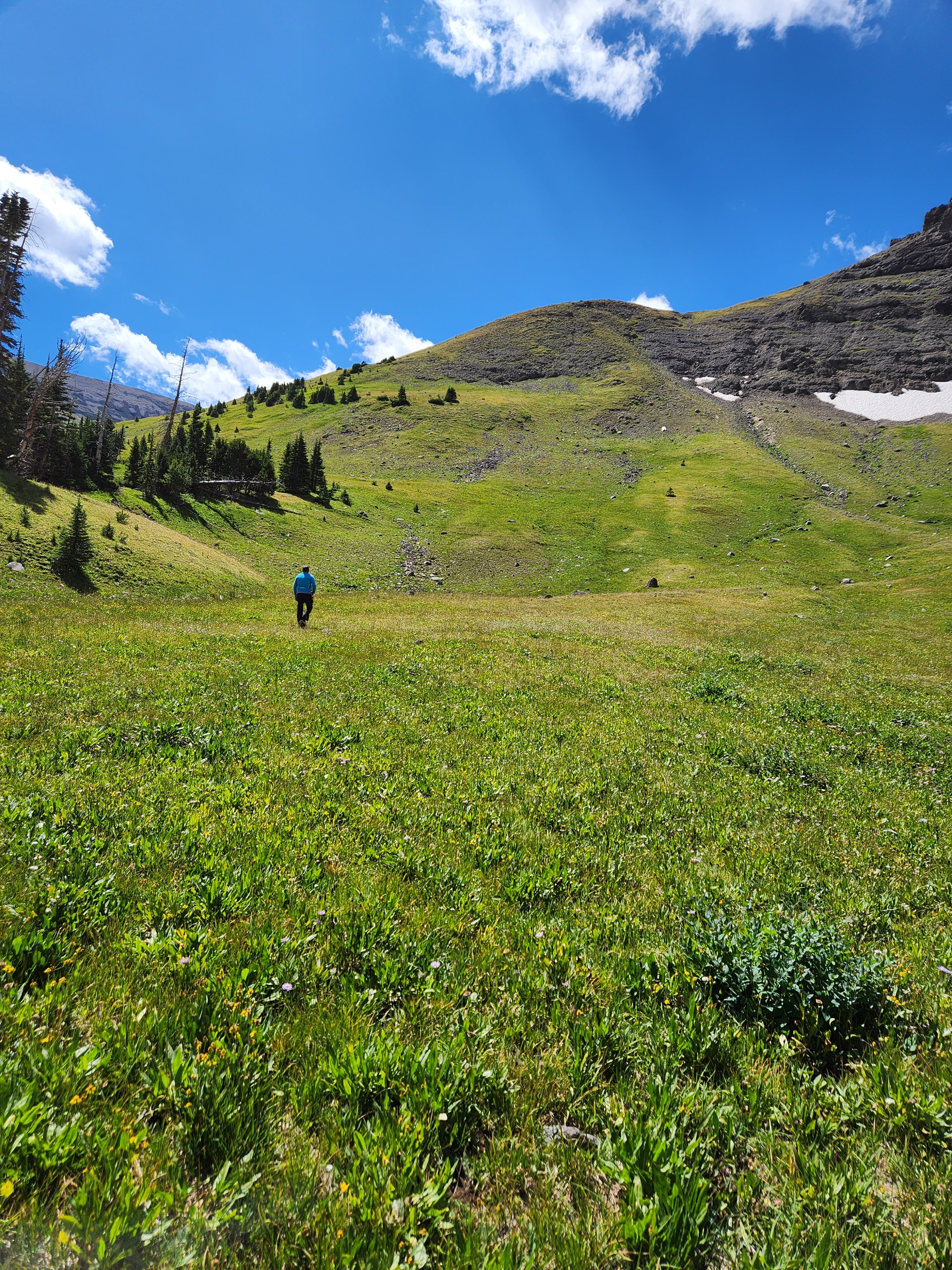
Just before the 8th mile we came upon some horse camps. This is where we sat to eat lunch and rest. There were bear boxes right by the camp that we were eating at, so we put our packs inside them to complete the hike without them. We kept our bear spray, water, and jackets with us for the last portion of the trail. We followed the trail past the horse camps, but it didn't continue very long after that. It just disappeared and all we had was grass in front of us surrounded by cliffs. We were in a sort of bowl-like area. This is where the pages from that hiking book really came in handy. He said "standing where the trees end and facing south, you see the vast and open high country and the surrounding cliff faces. The views of the natural bridge come from atop Sheep Mesa. Look at the cliffs to the south and a bit to the east, and you'll see one grassy area leading to the top of the mesa. A sort-of trail leading to that 1 break in the rock structure is also visible. The climb through that grassy break is steep -- not quite fourth-class scrambling, but close enough, and should only be attempted by those with some mountaineering experience." Without this description, I don't know how long it would have taken for us to figure out how to get up onto the mesa, or even if we were in the right spot to climb the mesa. We couldn't see the trail on the mesa, though, until we were about halfway up it and then we came upon the trail. We headed through the meadow towards what we thought was the break in the rocks that he had talked about. It was steep and just kept getting steeper. We reached the part of the mesa that really got steep, and I think that if I had understood what it would be like before I started the hike that morning, I might have decided not to do it. I am very afraid of heights, and this was the only point on the whole hike that heights was ever a problem. But by that point, and all the effort that we'd already put into the hike to reach this point, there was no way I wasn't going to see the arch at the end! So we started up the very steepest part of the mesa. We kept having to sit down and rest, and even when we were sitting it felt like we were going to slip down the mesa. I am guessing that we climbed 1,000 vertical feet just in this one last half mile section of the hike. I tried not to look back so that I wouldn't get scared. The whole time I was climbing up, I kept thinking, "I have no idea how I'm going to get back down this!" But my determination to see the arch kept me pushing on. About halfway up the mesa we saw a rock cairn and then another much larger rock cairn off in the distance. If you spot this very large rock cairn, go to it because then you'll come across the trail that the author of the hiking book talked about. Once we found that little trail, the hike up became easier. My son held my hand most of the way up, keeping me steady so I wouldn't fall back down the mesa. I joked that to get down, we could just lay down and roll all the way down. Of course, we really couldn't, because it was also totally covered in loose rocks. This was, without a doubt, the very most exhausting part of the hike. I run several miles a day and have run in half marathons, and I am positive that this was more physically exerting than anything else I have ever done. The author described this section like this: "Now the adventure begins. All of that uphill hiking has simply been preparation for the finale." Boy, what a finale!
 |
| the horse camp where we ate lunch |
 |
| the bear boxes where we left our packs while we completed the last portion of the trail |
 |
| This sign was right next to the bear boxes |
.JPG) |
| the trail leading from the horse camps |
.JPG) |
| view back in the direction of the horse camps after we had left the trees |
.JPG) |
| this trail soon dwindled and disappeared in the grass |
 |
|

 |
| melting glaciers near the mesa |
 |
| this melting patch of snow was the source of the glacier water we drank on the way down |
 |
| We hit mile 8 partway up the mesa |
 |
| panoramic view at mile 8 |
 |
| Teancum tried to take aesthetic photos for his sister Lizzie. There were pretty wildflowers on this portion of the trip, which he thought he'd get a picture of with his bear spray centered between them. |
.JPG) |
this is looking from the trail to the left - you can still see that mysterious other arch along the ridgeline, you just can't see the opening anymore.

You can see the break in the rocks that we ended up climbing through at the top of the mesa, about 2 inches from the right edge of this photo |
.JPG) |
| melting snow that made delicious glacier water that we drank further downstream after getting our packs out of the bear boxes (so we could filter the water) |
.JPG) |
| Teancum is standing at the bottom of the mesa. Above his right shoulder and a few inches over is the break in the rocks that we headed towards. There was not a trail at this point. We just walked through the grass and rocks. |
.JPG) |
| view so far from the ascent |
.JPG) |
James headed towards the mesa. It is hard to tell from the photos how steep this is or how far we still had to climb. Now the opening in the rocks is about 3 1/2 inches from the right edge of the photo
|
.JPG) |
| a rare large rock where we sat and rested. There were not very many good places to sit and rest |
.JPG) |
| this photo gives you a better idea of how steep it was. |
.JPG) |
| rocks off to the side of where we were climbing to the break in the rocks |
.JPG) |
| more views of the steep climb up the mesa |
.JPG) |
| view from partway up the mesa showing how steep it was down. I tried not to look back too much |
.JPG) |
| We finally spotted a trail that we could follow, which made it quite a bit easier, although it was still very rocky and easy to slip. It was also SO steep. This was pretty hard to come back down on. James and Teancum were very patient with me as I slowly made my way down, trying not to slip on all the loose rocks and tumble to the bottom of the mesa. |
.JPG) |
| I was really excited when I saw these stair-like rocks partway up the mesa |
 |
| this was about 2/3 of the way up the steep part of the mesa |
.JPG) |
| This large rock cairn was where we intersected the trail on the steep Sheep Mesa |
Sheer determination got us to the top of the mesa, and then as we started to summit it, we kept thinking we were going to see the arch any second. We kept walking faster, the mesa started to flatten out, we could only see blue sky above it, so we kept walking and walking for what felt like a long time, until... there it was! Poking itself over the top of the mesa - our view of the arch! The first view of the arch came at 8.54 miles into the hike. We were standing at 11,327 vertical feet. It had taken us 6 hours and 15 minutes to reach the summit of Sheep Mesa from the start of the trail.
 |
| the arch finally came into view! |
It had all been worth it! Blackwater has now become my very favorite arch, because of the incredible effort it took to see it! It is absolutely stunning, and I am SO glad I made the effort to get there! It is also a once-in-a-lifetime event, because there's no way I'm ever doing that hike again! But I'm also so very glad that I did it! We went as close to the edge of the mesa as we dared to, as the far side of it was a cliff even steeper than the side we had climbed up on. We were at least 1 mile away from the arch as we viewed it on top of Sheep Mesa. I don't know that if I'd been down in the valley between Sheep Mesa and the arch if I'd have been able to see it high up in the top of the cliffs. Looking at the arch and cliff that it resides in, I could not see any way that a person could get inside it, even with climbing gear. The rocks that we'd hiked through did not seem very steady. As we'd been climbing up the steep mesa during one of our rest breaks we heard a large rock falling and rolling down off the cliffs to the left of us as we were sitting. The only way I can imagine that the man in the Facebook video could have gotten on top of the arch was to be dropped off by helicopter. We sat and admired the arch for a while. We were glad we'd brought our jackets because the wind was very strong up there and it was cold on top of the mesa. We took lots and lots of photos of the most amazing arch I have ever seen!
.JPG)
.JPG)
.JPG) |
| me and my favorite arch |
.JPG) |
| James says that it is the most patriotic arch in the world, because of its shape like an eagle |
.JPG) |
| In August there was still melting snow on both sides of the mesa |
.JPG) |
| I could not see any safe way for anyone to climb into the arch from this side. |
.JPG) |
| view to the right of where we were sitting on the mesa and admiring the arch. Teancum figured that someone could probably walk along the bowl from the mesa to the side where the arch was, but once they hit the rocks there wouldn't be rock safe enough to hold them as they tried to climb into the arch. |
.JPG) |
| the edge of the grassy part of the bowl where it meets the rock just to the right of the arch |
.JPG) |
| I was SO happy to finally be up there! |
 |
| James didn't want to come as far down on the other side of the mesa as we did. Teancum and I were just trying to get as close to the arch as we possibly could. |
 |
| Teancum's panoramic view from where he was sitting |
 |
| James' panoramic view |
.jpg) |
| Some have estimated this arch at 280 feet high. To give you a comparison, the famous Delicate Arch in Arches National Park is 52 feet tall. Imagine stacking 5 1/2 Delicate Arches inside this arch! |
 |
| You can see the top of the mesa how it slopes upward on top. We had definitely summited it at the most ideal spot. |
 |
| Teancum standing on the edge admiring the arch |
 |
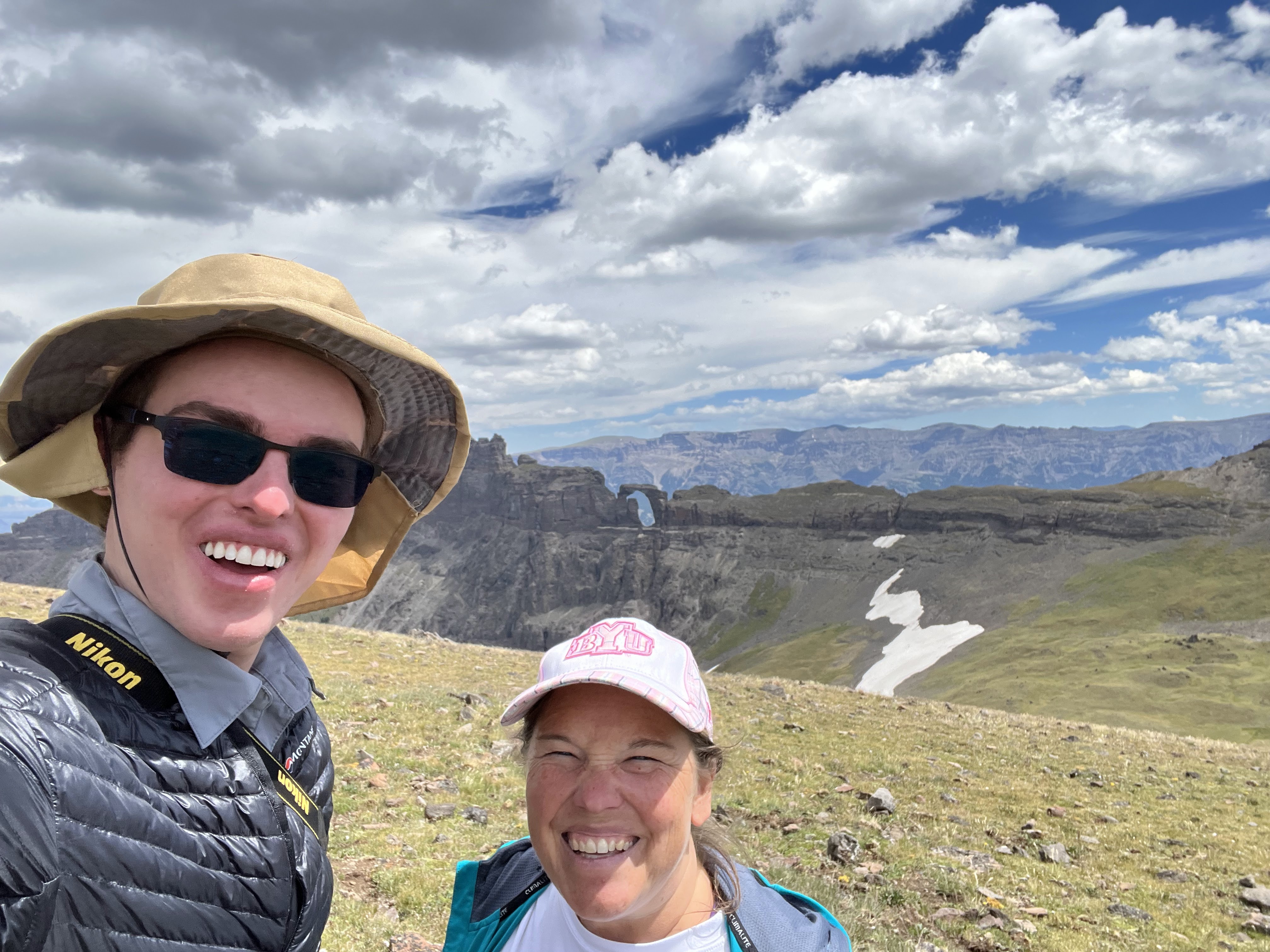
| One last selfie as we're getting ready to leave |
The wind was getting stronger and it was starting to sprinkle. The clouds blowing in looked threatening. So James told us our time on top of the mesa had to come to an end. We still needed to hike 8.5 miles back to our car! Sadly, we had to leave the arch. We started to very slowly make our way back down the steep mesa. James and Teancum both helped me all the way down the steepest part.
 |
| heading back up to the top of the mesa to begin our descent |
 |
| I turned around to catch a couple more glimpses of the arch |

 |
| my very last peek at the arch, probably for a lifetime |
 |
| vegetation on the way back down the mesa |
 |
| it's hard to see it in this photo, but we saw fools gold in lots of the rocks on the way down. |
.JPG)
 |
| We hit mile 9 on our way back down the mesa |
 |
| that mysterious arch again on our hike back down |
 |
| almost back to the horse camp where we'd left our packs in the bear boxes |
.JPG) |
| the horse camp where we'd eaten lunch |
I sat next to the little creek crossing and admired the mysterious arch for a while. James and Teancum used their water filter to fill our water bottles again. I am so glad we had the water filter with us because we would have run out of water otherwise.
 |
| This glacier water tasted so good! |
 |
| my view of what I call the Sheep Mesa Arch as I sat and waited for James and Teancum to filter water |
 |
| The source of this water was melting snow right by the mesa that we had just climbed |
 |
| mile 10 |
 |
| lots of trees had either fallen or been cut down to clear the trail |
 |
| mile 11 |
Right after we crossed the creek and I sat and switched my keens back to my shoes, we saw an area of flattened vegetation that James commented looked like an animal had been bedding in. And very soon after that, we saw fresh bear scat on the trail that had not been there on our way up. That got us all pretty nervous, and James said it was a good thing that I had taken the time to switch to my keens to cross the river, and then sitting and drying off my feet to put my socks and shoes back on. Otherwise he thinks we might have come upon the bear and her cubs. Based on the size of the scat, and the size of the small fresh paw prints that we saw less than a mile later, we figured a mom and possibly multiple cubs were somewhere on the path. We all became pretty nervous, started making even more noise than we were before, and kept our bear spray ready to go. We made it down the trail way faster than we'd gone up, mostly because we were hoping not to run into any bears -- especially not momma bears with cubs!
 |
| very large fresh bear scat |
 |
| new bear paw prints that hadn't been there on our way up the trail |
 |
| mile 12 |
 |
| mile 13 |
 |
| some older bear scat that we had seen on our way up |
Once we got past some muddy areas that didn't have bear prints in them, I started to feel less uneasy. We didn't ever see any bears, but James is pretty sure they saw us and just left us alone.
 |
| 14 miles |
 |
| back in the thick vegetation |
 |
| back to the fork in the road and the sign dividing the trail |
 |
| mile 15 |
 |
| we passed a large rock that had this cool yellow moss-like stuff all over it |
My one regret on the hike down was that we were in such a hurry to avoid bears that we didn't look back and get one last view of the arch. When we hit the 2 mile mark we remembered, but we would have had to turn around and hike back a little bit to see that first view again, and we weren't willing to do that. :)
 |
| Mile 16! Only one mile left to go! |
 |
| Since we were almost at the end of the hike, I crossed that first river crossing in my hiking shoes and socks. James still helped me across so I wouldn't slip and fall in. |
 |
| the end of the trail! |
We made it! That's our car behind us as we hit mile 17!! The full hike ended up being 17.02 miles! It took us almost eleven hours to do the whole thing. We were so exhausted and we smelled terrible by the time we finished! But we also felt proud of ourselves for persevering. If I had seen the steep mesa and decided to turn around, I know I never would have forgiven myself! The Blackwater Natural Bridge was SO worth it! It was worth every ounce of effort that it took to get there. I will never do that hike again. But if I were to learn about a way to get to the other side of the arch, I would be very tempted....
This was one of the most incredible days of my life! An unforgettable experience! And one that I will never repeat. :)
THIS was worth it!!!:


.JPG)


.JPG)
.JPG)
.JPG)
.JPG)
.JPG)
.JPG)
.JPG)


.JPG)
.JPG)
.JPG)


.JPG)

.JPG)
.JPG)
.JPG)

.JPG)
.JPG)
.JPG)
.JPG)
.JPG)
.JPG)
.JPG)
.JPG)
.JPG)
.JPG)
.JPG)

.JPG)

.JPG)
.JPG)
.JPG)
.JPG)
.JPG)
.JPG)
.JPG)
.JPG)
.JPG)
.JPG)
.JPG)
.JPG)
.JPG)
.JPG)
.JPG)
.JPG)
.JPG)
.JPG)
.JPG)
.JPG)
.JPG)
.JPG)


.jpg)


.JPG)


.JPG)
.JPG)
.JPG)
.JPG)


.JPG)


.jpg)
.png)
.JPG)


So helpful in planning a trip to the Arch. Thank y'all so much for a step by step guide, because there's hardly any information. Looks like an amazing trip.
ReplyDelete