Ayers Natural Bridge
 |
| Ayers Natural Bridge in October of 2026 |
Quick Stats:
.08 miles from the parking lot to be standing underneath the bridge
I live in Wyoming, and unfortunately we do not have very many arches! But we do have one very accessible natural bridge just outside of Douglas called Ayers Natural Bridge. It doesn't even require any hiking, you can park right next to it and go explore above and below it! It is beautiful there, as you can see from the photos and definitely worth the little side trip if you are driving anywhere near Douglas Wyoming.
The pamphlet that is available inside the pay booth at Ayers Natural Bridge details the history of the bridge. It states that Alva Ayers lived on the land in 1882. His step-son Andrew donated the land that houses the natural bridge to the county in 1920. The pamphlet also lists that Ayers Natural Bridge is one of only three natural bridges in the US with water flowing under it. If that were true, then I would have been to all 3 of them because Clear Creek Natural Bridge in Green River has water flowing under it, as does Natural Bridge in Massachusetts, which is the only white marble natural bridge in North America. I suspect that there are probably many more natural bridges with water running under them in the United States. In fact, Yellowstone Natural Bridge also has water running under it. Perhaps the pamphlet has a typo and it was actually meant to say that Ayers Natural Bridge is one of only three natural bridges in WYOMING that has water running under it. The bridge is 50 feet high and 100 feet long. There is a legend that an Indian brave was struck by lightning near the bridge and killed instantly. The pamphlet claims that after that, the Native American people wouldn't go near the bridge, and so settlers fearing the Indians would stay near the bridge for protection. Mountain men and Mormon settlers built cabins nearby in the 1850s, according to the pamphlet. I did not see any remaining cabins at my visits to the natural bridge.
On one of my visits to the natural bridge, first thing in the morning in early October, I had the natural bridge all to myself for about an hour. A few other cars came during the time I was there, but the visitors only looked at the natural bridge briefly and then went on their way. I was able to explore the entire area all by myself.
It is only a .08 mile walk from the parking lot to be standing underneath the bridge. It is extremely accessible to people of all abilities, although a wheelchair might not be able to be wheeled completely under the natural bridge, but a paved walkway and bridge make it possible for even someone in a wheelchair to get very close to the natural bridge.
There are a few different trails to climb on top of the natural bridge, each listed according to difficulty. The first time I climbed up the one marked "most difficult." It was definitely the fastest way to get to the top of the bridge, but coming down it may have been dicey for me. I decided to follow the trail to one of the easier options when I was climbing down. I ended up taking a side trail that turned out to be just a social trail and not one of the official marked trails in the state park. It took me down to a couple of picnic tables close to the bridge. I don't recommend taking that side trail because it was pretty slippery with loose rocks and was rather steep, and required me clinging to branches as I tried to support myself on the climb down. When you're climbing off the bridge and following the trail up top, there are some cacti when the trail separates to a fork on the left. Don't take that left fork -- that's the mistake I made. Just continue straight.
There is an easier/easiest option that I tried climbing up next, and it truly was very easy. They have built-in wooden stairs up to the path along the top. It is the easiest way to get back down as well. Then there is another trail that is over on the campground side and it is marked "more difficult." It was similar to the social trail that I came down the first time. It is very over-grown with brush and has loose rocks that could make you fall. My recommendation is to take the "most difficult" trail on the way up and the "easier-easiest" trail on the way down.
If you are a little unstable on your feet, don't go on top of the natural bridge by yourself. It is quite wide, but it is not at all flat on top of the natural bridge. It is very rocky with several different levels. I am deathly afraid of heights, and even though I've been on top of the natural bridge a few times before, I was completely by myself and honestly pretty scared. I didn't stay up there very long -- just took a few photos and videos, sat on the ledge for awhile and then climbed down. And then I went back up again a couple times since I was trying out each of the trails. Admittedly, the second and third time up on top of the natural bridge by myself weren't as scary as the first time. But it still would be pretty easy to fall off the bridge if I tripped on some of the jagged rocks up there and took a tumble. Don't let kids roam around up there by themselves!
Partway across the natural bridge is a large change in elevation and a sign that says you can't climb beyond that point. There is what I would describe as a tower on top of the arch, similar to Tower Arch in Arches National Park (except that tower is actually not really on top of the arch, it only appears that way - it is behind the arch). The tower adds quite a bit of height to the natural bridge and is probably the reason for the "no climbing beyond this point" sign. I wonder if people have been hurt trying to climb on top of the tower in the past.
There is also a sign on top of the natural bridge that says "don't throw rocks off bridge." With as much activity as the natural bridge sees in a day, I can definitely see the need for this sign. Imagine admiring the bridge from below and suddenly a rock lands on your head.
You are able to admire the natural bridge from both sides. In order to see the back side of the natural bridge, just walk over to the camping area and through the grass to see the back side. Both sides of the bridge are beautiful.
There are a couple different playgrounds at Ayers Natural Bridge State Park, and I saw at least 4 different sets of rest rooms. There is a volleyball net and lots of picnic areas. It is definitely ready to accept visitors! I expected to pay a fee as I entered, but there was just an open visitor booth with a locked metal box for donations. I'm not sure what the expected donation is, but I put $5 in the box on my most recent visit.
As I was admiring the red cliffs that surround the natural bridge, I was positive that I spotted an arch up in the red cliffs near the office. I got as close as I could, but there is a sign that warns not to climb on the high cliffs. As I was leaving the parking lot, I stopped and got several photos of what I was sure was an arch. It really looked like an arch! I pulled over by the office, which is a house with a downstairs door that is marked "Office" and rang the bell. I pointed at what I thought was the arch and asked the lady working in the office if it was an arch. She said no, it's just a small cave or alcove but not an arch. Honestly, I didn't really believe her, because it absolutely looked like an arch, and I even thought I could see the shadow of the arch beneath it. It wasn't until I got home and looked at my zoomed-in photos on my computer that I believed her -- it is not an arch. But it sure looks like an arch! It is an optical illusion with one rock in front of another and the shadow of the rock underneath it, but not an arch.
 |
| 2020, our family by the back side of the bridge |
 |
| If you exit the highway in the direction of Casper, you'll see this sign to turn left towards Ayers Natural Bridge. If you've come from Casper, just watch for the signs to leave the highway and head right. |
 |
| The path to the bridge is very well marked |
 |
| Drive for 5 miles until you reach the state park |
 |
| This sign is right after exiting the highway |
 |
| the road to the bridge |
 |
| When I visited the natural bridge in October of 2026 there was construction near the state park |
 |
| the entrance to the park |
 |
| all of these signs are posted at the entrance |
 |
| the road into the park |
 |
| this old abandoned power building was built in the early 1900's. It's right next to the natural bridge. You pass it as you're driving in. |
 |
| The "not responsible for accidents" is probably referring to falling off the bridge... |
 |
| This is the fee booth. There wasn't an employee inside. It is just self-pay by donation |
 |
| inside the payment booth |
 |
| the donation box |
 |
| heading to the parking lot |
 |
| one of the playgrounds at Ayers Natural Bridge. This one is near the parking lot. Up high in the cliffs is what I thought was an arch, but it turns out it's only a small cave or indentation |
 |
| one of the bathrooms at the state park. This one is next to the parking lot |
 |
| when I arrived I was the only car in the parking lot |
 |
| there is plenty of room in the parking lot for a lot of cars |
 |
| the walk from the parking lot to the bridge which leads to the natural bridge |
 |
| the bridge to the natural bridge |
 |
| the bridge is accessible for those with disabilities |
 |
| the bridge already in sight |
 |
| under the bridge |
 |
| the other side, under the bridge. You can walk completely under the bridge, even though a stream runs through it. |
 |
| looking up at the bridge |
 |
| looking at the under-side of the bridge |
 |
| standing under the bridge |
 |
| the river that runs to the arch -- view from under the arch |
 |
| standing underneath the arch, this is the path that leads to the back side of the arch |
 |
| looking up from underneath the arch |
 |
| view out the front of the arch |


 |
| looking over the edge of the bridge |
 |
| getting ready to head back off the natural bridge |
 |
| looking back at the bridge and the tower |
 |
| the path on top |
 |
| looking at the surrounding red cliffs |
 |
| the path is very easy to follow |
 |
| cacti up on top |
 |
| this is the social trail that I took down the first time -- I don't recommend it |
 |
| I had to hold onto the side branches to keep from slipping on the loose rocks |
 |
| almost to the bottom of the trail |
 |
| this root is a tripping hazard near the end of this social trail |
 |
| these picnic tables are at the bottom of the social trail |
 |
| looking back up at the social trail |
 |
| this is the "easier/easiest" trail. It really is easy, to get both up and down. This trail is a little bit farther away from the parking lot. Head back towards the pay booth and you will see this trail. |
 |
| up on top again |
 |
| looking at the top of the bridge from the trail |
 |
| looking down from the trail |
 |
| this bunch of cacti on the left is where the trail forks and to the left is the social trail that I do not recommend taking. Keep going straight when you see the cacti. |
 |
| continuing on the trail up top |
 |
| walking down the easy trail |
 |
| another set of bathrooms. This one is closest to the pay booth |
 |
| the pay booth and the office |
 |
| this "more difficult" trail is in the camping area of the state park |
 |
| heading up the more difficult trail |
 |
| it's not bad going up |
 |
| back up on the top trail again |
 |
| heading back down the more difficult trail - it is about like the social trail that I took down by accident |
 |
| the camping area of the state park |
 |
| heading to the back of the natural bridge |
 |
| the back side of the natural bridge |
 |
| looking through the back side of the arch |
 |
| looking up at the tower from the back side of the arch |
 |
| underneath the bridge from the back side |
 |
| the river that runs through the natural bridge, from the back side trail behind the bridge |
 |
| looking back at the bridge from the trail |
 |
| the path by the river |
 |
| the path leads to the old power building |
 |
| it walks alongside the old power building |
 |
| it continues to the water's edge |
 |
| the river |
 |
| heading back to the start of the trail |
 |
| pipe into the water |
 |
| beautiful reflection of the rock wall that houses the natural bridge onto the river that runs through it |
 |
| unique formation in the surrounding cliffs |
 |
| looking up at the red cliffs |
 |
| this is inside one of the bathrooms |
 |
| In the upper right is what I thought was an arch. It turned out not to be. These are the red cliffs on the side of the office. |
 |
| the playground next to the parking lot |
 |
| view through the brush of what I thought might be an arch -- it isn't |
 |
| it is just a small cave or indentation |
 |
| the brush was too thick to get a clear photo from below |
 |
| This is a creative way to deal with an old tree stump. It is located in the playground section near the parking lot. |
 |
| I was joined by this bunny as I explored the park |
 |
| A couple cars joined me for a few minutes while I was there, but when I left, I was once again alone at the park. |
 |
| covered picnic area |
 |
| another of the bathrooms |
 |
| I followed this path until it ended abruptly with a fence. |
 |
| This garbage can sits at the end of the path. Ivy covers the chain-link fence that prevents you from exploring any further. |
 |
| The fence goes all the way across the river |
 |
| This old stove is just sitting in the bushes at the park |
 |
| I wonder who put this monkey in the tree |
 |
| one last visit to the natural bridge before I headed out |
 |
| As I was pulling out of the parking lot, I stopped to take some zoomed-in photos of what I thought was an arch. |
 |
| It's an optical illusion. I was convinced it was an arch. |
 |
| I thought I was a ribbon arch, and even saw its shadow underneath it |
 |
| But when I got home and looked at the photos on my computer I could see that it is just a rock that was appearing to be the arch opening. The shadow of what I thought was from the arch, is from the rock. |
 |
| the construction on the way back to the higway |
 |
| the walk from the parking lot to be standing underneath the natural bridge |
 |
| 2020, the back side of the bridge |
 |
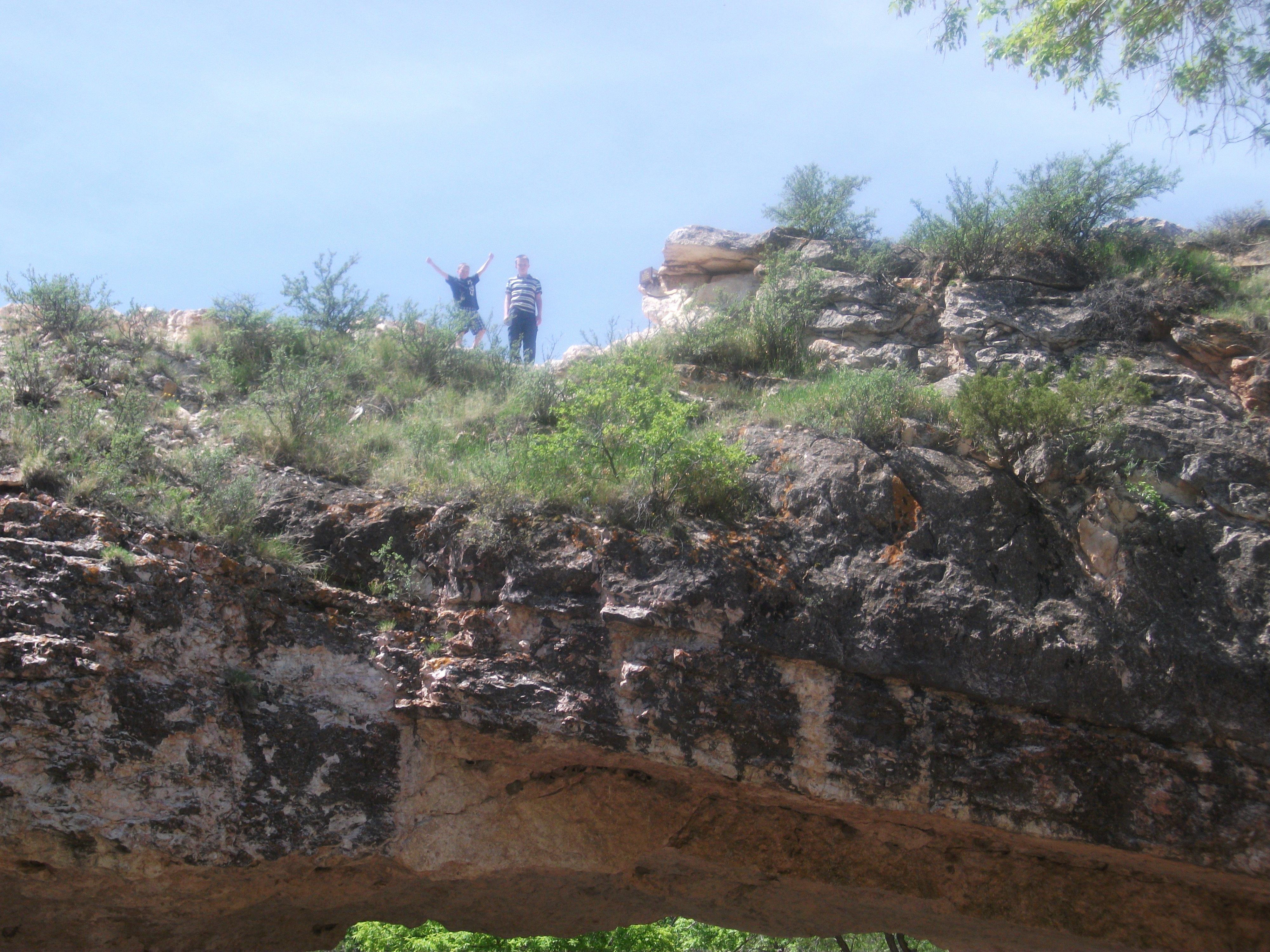
| my kids on top of the bridge, 2020 |
 |
| under the bridge, in front, 2020 |
 |
| 2020, my husband and I and our photo-bombing daughter Lizzie under the bridge. :) |
 |
| 2020 |
 |
| 2020, our family in front of the river by the bridge |
 |
| 2020, our family on top of the bridge |
 |
| 2020, the view looking down from the bridge |
 |
| 2011, my kids on top of the bridge |
 |
| 2011 |
 |
| My son Micah on top of the bridge, 2011 |
 |
| 2011 |
 |
| 2011 |
 |
| 2011, our family under the bridge |
 |
2020, my daughters and husband on top of the bridge from the front side
|
Here are some items that might enhance your visit to Wyoming:
As an Amazon Associate, I earn on qualifying purchases. This is at no additional cost to you.
Other Arches in the Area:
Ayers Natural Bridge




No comments:
Post a Comment