Elephant Arch
When visiting Saint George in June 2025, we decided to hike to Elephant Arch, which I'd read about online. We knew that the Saint George sun can be extremely hot, so we left early in the morning to arrive at the trailhead right at sunrise. We followed the directions from google maps that were supposed to take us to the trailhead, but they ended abruptly at a locked gate. This actually is the beginning of the hike. If you want to leave your google maps on for the beginning of the hike, it will continue to navigate you into the wash, although you can easily find your way yourself by simply following the electric poles. When turning off the paved road onto the dirt road, Google Maps tries to have you turn at what I'm guessing used to be the beginning of the dirt road, but now it's been blocked by developers so that you can't turn there. The turn onto the dirt road is just a little bit past there.
The hike is just under 4 miles round-trip and is mostly sand the entire way. It is pretty easy to follow the trail, with markers for both Bone Wash and Elephant Arch along the way, as well as cairns and lots of footprints. Without the signs, I'm not sure I would have found it because there are a few turns along the way. For a lot of the hike you are simply following the electric poles. There is some elevation gain, but it is generally a very moderate hike. There is a tiny bit of climbing at the end, and my husband had to help me down the scariest parts when coming back. The arch is a lot of fun, though, and you can climb under, around, and on top of it. I had heard that we might encounter rattlesnakes, but one of the benefits of hiking early in the morning is that the snakes weren't out yet.
 |
| While driving on the dirt road, this sign is visible, showing that you continue straight to make it to the Mill Creek trailhead. |
.JPG) |
| The gate where we parked our car and began the hike - Mill Creek |
.JPG) |
| Although we drove for nearly 2 miles on a dirt road that was sometimes bumpy, we were very near civilization the entire time. Our car was the only one in the lot when we left on the hike, but when we finished the hike there were 2 others. I had read that at times the lot fills up. |
.JPG) |
| looking back at the road we drove in on |
.JPG) |
| This sign is just inside the gate at the trail-head |
.JPG) |
| The parking lot is called Mill Creek |
.JPG) |
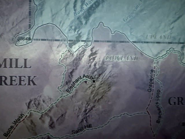
| Elephant Arch is marked on the map |
.JPG) |
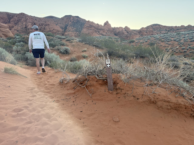
| The beginning of the trail |
.JPG) |
| At only about .3 miles into the hike you will come to a junction. Go to the right, following signs for Bone Wash. This follows along the electric poles. |
.JPG) |
| This is the junction. Turn right. |
.JPG) |
| view from the trail |
.JPG) |
| Right after this water pump station the trail takes you down into the wash |
.JPG) |
| The signs make it pretty clear where to go, but if you follow the electric poles until they end, that is where you'll be going down into the wash |
.JPG) |
| heading down into the wash |
.JPG) |
| the wash is very wide and completely sandy - there isn't really a way to navigate through it while avoiding the sand. |
.JPG) |
| The majority of the hike is down in this sandy wash |
.JPG) |
| pretty wildflowers along the trail |
.JPG) |
| view from the trail |
.JPG) |
| A cairn! I am always really excited to see cairns! |
.JPG) |
| The elephant arch sign had fallen over. My husband propped it back up and anchored it with the rocks surrounding it. |
.JPG) |
| The uphill portions of sand were almost the hardest part of the hike. |
.JPG) |
| Without the signs it would be very easy to go astray |
.JPG) |
| tiny arch along the trail |
.JPG) |
| This cairn near the end of the hike is helpful in finding the best route to the arch |
.JPG) |
| This was when I first spotted the arch -- since there isn't sky behind it it's hard to see it, but it's in about the middle of this photo. |
.JPG) |
| The arch is in the very center of this photo |
.JPG) |
| This view is easier to see the arch |
.JPG) |
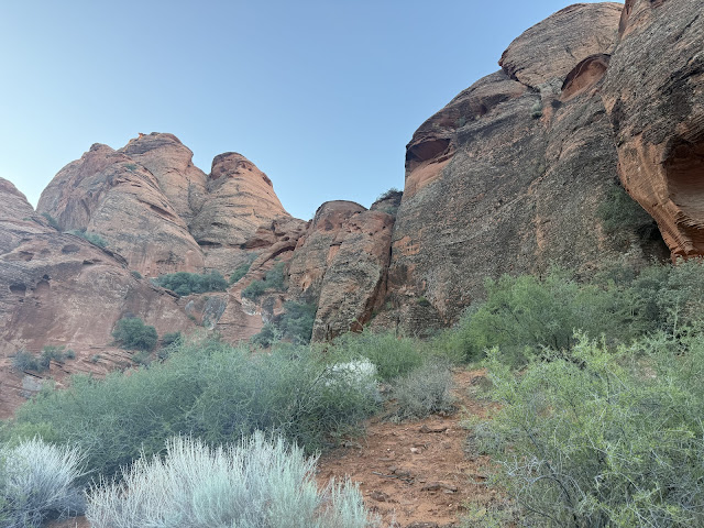
| This is where the slick-rock climbing section of the hike begins |
.JPG) |
| There are a few ways to get up to the arch. We figured out which one would be least difficult, although none of them are easy. |
.JPG) |
| We climbed up this rock section |
.JPG) |
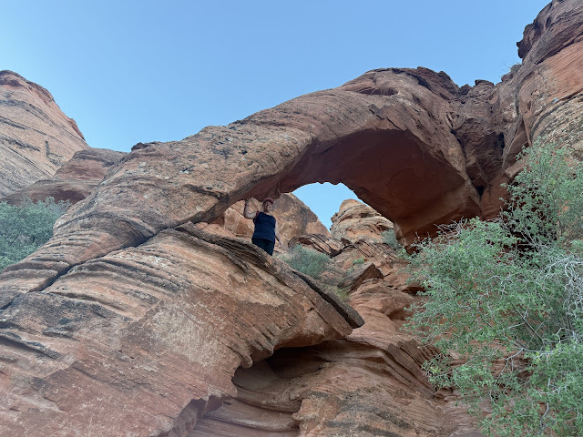
| Once you make it to the arch you can easily climb under, around, and on top of it |
.JPG) |
| The other side of the arch |
.JPG) |
| Me standing under the arch |
.JPG) |
| Me standing above the arch |
.JPG) |
| It's kind of hard to tell, but this is the top of the arch |
.JPG) |
| view up above the arch |
.JPG) |
| Me standing on top of the arch - it is hard to tell that I am up above the ground |
.JPG) |
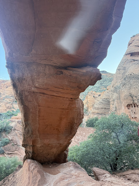
| This is the best view of the "elephant" since you can see both his eye and his trunk |
.JPG) |
| My husband and I underneath the arch |
.JPG) |
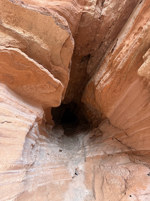
| Underneath the arch |
.JPG) |
| This is underneath the arch as well |
.JPG) |
| Facing the arch head-on |
.JPG) |
| climbing back down the steep part |
.JPG) |
| The slickrock was pretty grippy, although my husband did help me down because there were loose rocks rolling down past our feet |
.JPG) |
| The steep part that we climbed |
.JPG) |
| My last view of the arch as we headed back |
.JPG) |
| The sun coming over the mountains just as we started to hike back to the trailhead |
.JPG) |
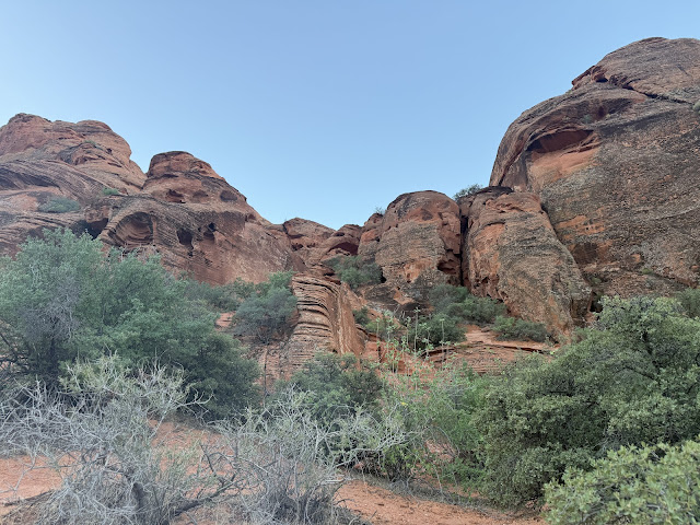
| I liked this hol-ey mountain |
.JPG) |
| I was grateful for the trail markers on the way back as well |
.JPG) |
| the trail back up out of the wash |
.JPG) |
| when the electrical poles start again that's where the trail up above starts again |
.JPG) |
| beautiful wild flowers |
.JPG) |
| The water pump station |
.JPG) |
| The junction in the road leading back to the trailhead |
.JPG) |
| This is the junction where you go left to head back to your car. Don't continue straight towards that small building. |
.JPG) |
| The road from the trail head - not too bad, but a high clearance vehicle is nice |
 |
| The trailhead is not very far off I-15 |
I noticed after we visited that there is also a Baby Elephant Arch nearby -- that one became the next destination on my hiking list!
.JPG)

.JPG)
.JPG)
.JPG)
.JPG)
.JPG)
.JPG)
.JPG)
.JPG)
.JPG)
.JPG)
.JPG)
.JPG)
.JPG)
.JPG)
.JPG)
.JPG)
.JPG)
.JPG)
.JPG)
.JPG)
.JPG)
.JPG)
.JPG)
.JPG)
.JPG)
.JPG)
.JPG)
.JPG)
.JPG)
.JPG)
.JPG)
.JPG)
.JPG)
.JPG)
.JPG)
.JPG)
.JPG)
.JPG)
.JPG)
.JPG)
.JPG)
.JPG)
.JPG)
.JPG)
.JPG)
.JPG)
.JPG)
.JPG)
.JPG)
.JPG)
.JPG)
.JPG)
.JPG)
.JPG)
.JPG)
.JPG)
.JPG)
.JPG)
.JPG)
.JPG)
.JPG)
.JPG)
.JPG)
.JPG)
.JPG)
.JPG)
.JPG)
.JPG)
.JPG)
.JPG)
.JPG)
.JPG)
.JPG)
.JPG)
.JPG)
.JPG)
.JPG)
.JPG)
.JPG)
.JPG)
.JPG)
.JPG)
.JPG)
.JPG)
.JPG)
.JPG)
.JPG)
.JPG)
.JPG)
.JPG)
.JPG)
.JPG)
.JPG)
.JPG)
.JPG)
.JPG)
.JPG)
.JPG)
.JPG)
.JPG)
.JPG)
.JPG)
.JPG)
.JPG)
.JPG)
.JPG)
.JPG)
.PNG)

.JPG)


No comments:
Post a Comment